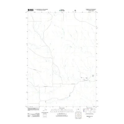
2012 Map of Fairburn NE
USGS Topo · Published 2012About this map
French Creek and its complex of tributaries, including the S Fork French Cr, dominate this southwestern South Dakota landscape in the early 21st century. The map reveals a remote pastoral and recreational environment where local transit is defined by routes like Dry Creek Rd and E French Creek Rd. These roads traverse an area marked by distinct drainage features such as Shorty Draw and Sheep Camp Draw, which speak to the region's ranching history and topographical character.
Find a feature on this map
12 named features on this map. Tap any name to fly to it.
Don’t see what you’re looking for? This feature index may not catch every label — zoom into the map to look around manually.
Map Details
Editions of this 2012 Fairburn NE Map
This is the sole edition of this map. No revisions or reprints were ever made.
Other maps of this area

1894 · Hermosa
USGS Topo · 1:125,000

1901 · Hermosa
USGS Topo · 1:125,000

1951 · Fairburn SE
USGS Topo · 1:24,000

1951 · Red Shirt
USGS Topo · 1:24,000

1951 · Red Shirt SW
USGS Topo · 1:24,000

1953 · Hermosa
USGS Topo · 1:24,000

1953 · Hermosa SE
USGS Topo · 1:24,000

1953 · Caputa SW
USGS Topo · 1:24,000

1955 · Hot Springs
USGS Topo · 1:250,000
1957 · Fairburn NE
USGS Topo · 1:24,000