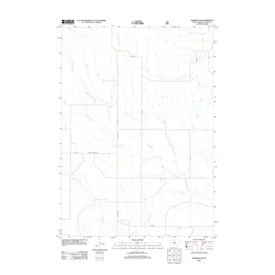
2012 Map of Fairburn SW
USGS Topo · Published 2012About this map
Pioneer Park Ground sits at the heart of this Custer County landscape, where the prairie topography is defined by the wandering drainage systems of the Black Hills foothills. The map documents a sparse network of county infrastructure and ranch roads, such as Co Hwy-719 and S Fairburn Rd, which navigate the various seasonal waterways. Three primary creek systems—S Fork French Cr, Cottonwood Cr, and Lame Johnny Cr—cross the terrain, showing the natural erosion patterns and riparian corridors essential to this arid region. This 2012 survey provides a precise look at the land division and transportation layout prior to more modern developments, preserving the location of local landmarks and rural corridors like Co Hwy-656 and S Fork Rd.
Find a feature on this map
12 named features on this map. Tap any name to fly to it.
Don’t see what you’re looking for? This feature index may not catch every label — zoom into the map to look around manually.
Map Details
Editions of this 2012 Fairburn SW Map
This is the sole edition of this map. No revisions or reprints were ever made.
Other maps of this area

1894 · Hermosa
USGS Topo · 1:125,000

1896 · Oelrichs
USGS Topo · 1:125,000

1900 · Oelrichs
USGS Topo · 1:125,000

1901 · Hermosa
USGS Topo · 1:125,000

1950 · Buffalo Gap
USGS Topo · 1:24,000

1951 · Fairburn SE
USGS Topo · 1:24,000

1951 · Smithwick NE
USGS Topo · 1:24,000

1951 · Smithwick NW
USGS Topo · 1:24,000

1955 · Hot Springs
USGS Topo · 1:250,000
1957 · Fairburn NE
USGS Topo · 1:24,000