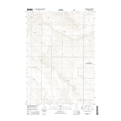
2015 Map of Fairburn SW
USGS Topo · Published 2015About this map
Buffalo Gap National Grassland dominates the eastern landscape of this Custer County region, where the prairie transitions into a network of seasonal drainages. The hydrology of the area is defined by the winding courses of Lame Johnny Cr, Cottonwood Cr, and the S Fork French Cr, which carve through the terrain as they flow generally eastward. This 2015 survey illustrates a sparsely populated ranching landscape organized by a grid of rural routes including S Fairburn Rd, Cottonwood Cutoff, and Riverside Rd. The absence of dense town sites highlights the importance of these connecting corridors and water sources in the high plains. Researchers can trace the section lines and township boundaries like t5s r8e and t6s r7e that have defined land ownership and grazing rights in this part of South Dakota for generations.
Find a feature on this map
17 named features on this map. Tap any name to fly to it.
Don’t see what you’re looking for? This feature index may not catch every label — zoom into the map to look around manually.
Map Details
Editions of this 2015 Fairburn SW Map
This is the sole edition of this map. No revisions or reprints were ever made.
Other maps of this area

1894 · Hermosa
USGS Topo · 1:125,000

1896 · Oelrichs
USGS Topo · 1:125,000

1900 · Oelrichs
USGS Topo · 1:125,000

1901 · Hermosa
USGS Topo · 1:125,000

1950 · Buffalo Gap
USGS Topo · 1:24,000

1951 · Fairburn SE
USGS Topo · 1:24,000

1951 · Smithwick NE
USGS Topo · 1:24,000

1951 · Smithwick NW
USGS Topo · 1:24,000

1955 · Hot Springs
USGS Topo · 1:250,000
1957 · Fairburn NE
USGS Topo · 1:24,000