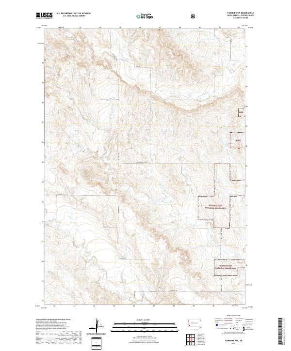
2021 Map of Fairburn SW
USGS Topo · Published 2021About this map
Buffalo Gap National Grassland dominates the southeastern quadrant of this Custer County landscape, where the prairie transitions through complex drainages. This modern survey illustrates the intricate watershed formed by Cottonwood Cr, S Fork French Cr, and Lame Johnny Cr, which carve through the high plains. The transport network is defined by rural arteries like S Fairburn Rd and the Cottonwood Cutoff, reflecting the enduring cattle-ranching and grassland management patterns of Western South Dakota. Small pockets of Bgng (Buffalo Gap National Grassland) land are interspersed throughout the northern sections, showing the mosaic of public and private land typical of the region. The map also traces the path of Old Hwy 79 S, providing a point of reference for those studying historical travel routes through the Black Hills periphery.
Find a feature on this map
17 named features on this map. Tap any name to fly to it.
Don’t see what you’re looking for? This feature index may not catch every label — zoom into the map to look around manually.
Map Details
Editions of this 2021 Fairburn SW Map
This is the sole edition of this map. No revisions or reprints were ever made.
Other maps of this area

1894 · Hermosa
USGS Topo · 1:125,000

1896 · Oelrichs
USGS Topo · 1:125,000

1900 · Oelrichs
USGS Topo · 1:125,000

1901 · Hermosa
USGS Topo · 1:125,000

1950 · Buffalo Gap
USGS Topo · 1:24,000

1951 · Fairburn SE
USGS Topo · 1:24,000

1951 · Smithwick NE
USGS Topo · 1:24,000

1951 · Smithwick NW
USGS Topo · 1:24,000

1955 · Hot Springs
USGS Topo · 1:250,000
1957 · Fairburn NE
USGS Topo · 1:24,000