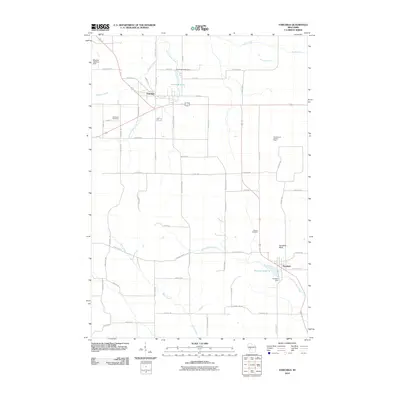
2010 Map of Fairchild
USGS Topo · Published 2010About this map
Fairchild and Humbird serve as the primary hubs in this western Wisconsin landscape, where the terrain is defined by the headwaters of Halls Creek and the East Fork Halls Creek. The region maintains a rural character dominated by a grid of county roads and family-named landmarks like the Cleveland Cemetery and Mentor Cemetery. Water management is central to the area's geography, evidenced by the Fairchild C4772 Dam creating Fairchild Pond and the Humbird Dam regulating Emerson Lake 10. Significant elevations such as Humbird Bluff and the site of the Twin Mound Lookout Tower provide orientation points above the creek valleys. The presence of the Stephen Landing Strip in the northwest suggests a reliance on small-scale aviation within this agricultural and timber-influenced corridor.
Find a feature on this map
61 named features on this map. Tap any name to fly to it.
Don’t see what you’re looking for? This feature index may not catch every label — zoom into the map to look around manually.
Map Details
Editions of this 2010 Fairchild Map
This is the sole edition of this map. No revisions or reprints were ever made.
Other maps of this area

1924 · Black River Falls
USGS Topo · 1:62,500

1926 · Black River Falls
USGS Topo · 1:62,500

1927 · Blair
USGS Topo · 1:62,500

1935 · Osseo
USGS Topo · 1:48,000

1940 · Osseo
USGS Topo · 1:62,500

1948 · Fairchild
USGS Topo · 1:62,500

1949 · Fairchild
USGS Topo · 1:62,500

1953 · Eau Claire
USGS Topo · 1:250,000

1958 · Eau Claire
USGS Topo · 1:250,000

1964 · Eau Claire
USGS Topo · 1:250,000