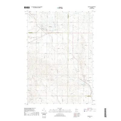
2018 Map of Fairchild
USGS Topo · Published 2018About this map
The village of Fairchild sits at a geographic crossroads where Eau Claire, Clark, and Jackson Counties converge. This 2018 survey detail shows a landscape defined by its riparian corridors and local history, where Fairchild Pond and the headwaters of Schoolhouse Cr meet a grid of residential streets including W Main St and North St. To the southeast, the village of Humbird lies beneath the distinctive elevation of Humbird Bluff, marking a transition toward the winding path of E Fork Halls Cr.
Find a feature on this map
68 named features on this map. Tap any name to fly to it.
Don’t see what you’re looking for? This feature index may not catch every label — zoom into the map to look around manually.
Map Details
Editions of this 2018 Fairchild Map
This is the sole edition of this map. No revisions or reprints were ever made.
Other maps of this area

1924 · Black River Falls
USGS Topo · 1:62,500

1926 · Black River Falls
USGS Topo · 1:62,500

1927 · Blair
USGS Topo · 1:62,500

1935 · Osseo
USGS Topo · 1:48,000

1940 · Osseo
USGS Topo · 1:62,500

1948 · Fairchild
USGS Topo · 1:62,500

1949 · Fairchild
USGS Topo · 1:62,500

1953 · Eau Claire
USGS Topo · 1:250,000

1958 · Eau Claire
USGS Topo · 1:250,000

1964 · Eau Claire
USGS Topo · 1:250,000