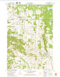
1979 Map of Fairchild
USGS Topo · Published 1980About this map
Fairchild serves as a central hub on this late-1970s survey, where the Chicago And North Western railroad corridor meets the local road network. The landscape is a mix of agricultural clearings and forested ridges, notably marked by Twin Mound and the Lookout Tower to the south. Along the border of Eau Claire and Jackson counties, the terrain transitions into the lowlands of Halls Creek and the East Fork.
Find a feature on this map
30 named features on this map. Tap any name to fly to it.
Don’t see what you’re looking for? This feature index may not catch every label — zoom into the map to look around manually.
Map Details
Editions of this 1979 Fairchild Map
This is the sole edition of this map. No revisions or reprints were ever made.
Other maps of this area

1924 · Black River Falls
USGS Topo · 1:62,500

1926 · Black River Falls
USGS Topo · 1:62,500

1927 · Blair
USGS Topo · 1:62,500

1935 · Osseo
USGS Topo · 1:48,000

1940 · Osseo
USGS Topo · 1:62,500

1948 · Fairchild
USGS Topo · 1:62,500

1949 · Fairchild
USGS Topo · 1:62,500

1953 · Eau Claire
USGS Topo · 1:250,000

1958 · Eau Claire
USGS Topo · 1:250,000

1964 · Eau Claire
USGS Topo · 1:250,000