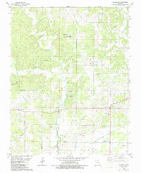
1979 Map of Fairdealing
USGS Topo · Published 1986About this map
The Little Black River winds through the borderlands of Butler and Ripley counties, defining a landscape shaped by creek bottomlands and timbered ridges. Near the settlement of Fairdealing, the terrain is marked by numerous family and community landmarks, including Military Cem, Dickens Cem, and Cochran Cem. These sites, alongside rural congregations like New Harmony Ch and Oak Ridge Ch, reflect the deep-rooted social fabric of the area in the late 1970s. The presence of the Lone Hill Lookout Tower and the State Public Hunting Area suggests the importance of forest management and recreation in this part of Missouri. On the eastern edge of the survey, the Old Railroad Grade and the Wattle Landing Strip near the river signify different eras of transport and access, while the Hillview Sch and several Gravel Pits point to the local infrastructure of the period.
Find a feature on this map
42 named features on this map. Tap any name to fly to it.
Don’t see what you’re looking for? This feature index may not catch every label — zoom into the map to look around manually.
Map Details
Editions of this 1979 Fairdealing Map
2 editions found
Other maps of this area

1934 · Williamsville
USGS Topo · 1:48,000

1935 · Poplar Bluff
USGS Topo · 1:62,500

1935 · Acorn
USGS Topo · 1:62,500

1935 · Harviell
USGS Topo · 1:62,500

1939 · Poplar Bluff
USGS Topo · 1:62,500

1940 · Williamsville
USGS Topo · 1:62,500

1940 · Naylor
USGS Topo · 1:62,500

1944 · Naylor
USGS Topo · 1:62,500

1949 · Poplar Bluff
USGS Topo · 1:62,500

1957 · Poplar Bluff
USGS Topo · 1:250,000