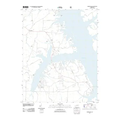
2011 Map of Fairdealing
USGS Topo · Published 2011About this map
Kentucky Lake dominates this landscape, its expansive waters defining the geography of Marshall County at the start of the 2010s. The settlement of Fairdealing sits inland to the northwest, while Aurora anchors the southeastern corner near the shoreline. The map reveals a high density of ancestral burial grounds, including the Price Cemetery, McLoad Cemetery, and Collie Cemetery, which are scattered throughout the wooded peninsulas and drainage basins.
Find a feature on this map
55 named features on this map. Tap any name to fly to it.
Don’t see what you’re looking for? This feature index may not catch every label — zoom into the map to look around manually.
Map Details
Editions of this 2011 Fairdealing Map
This is the sole edition of this map. No revisions or reprints were ever made.
Other maps of this area

1936 · Mont
USGS Topo · 1:24,000

1936 · Fenton
USGS Topo · 1:24,000

1936 · Hardin
USGS Topo · 1:24,000

1936 · Hiatt
USGS Topo · 1:24,000

1936 · Benton
USGS Topo · 1:48,000

1936 · Birmingham
USGS Topo · 1:24,000

1936 · Golden Pond
USGS Topo · 1:48,000

1936 · Rushing
USGS Topo · 1:24,000

1936 · Dexter
USGS Topo · 1:24,000

1936 · Hico
USGS Topo · 1:24,000