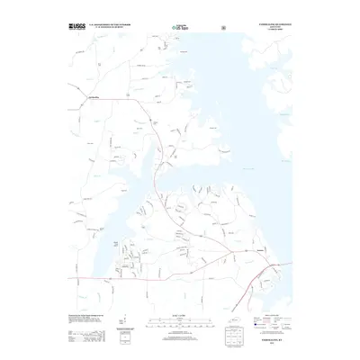
2013 Map of Fairdealing
USGS Topo · Published 2013About this map
Fairdealing and Aurora anchor this detailed survey of the western shoreline of Kentucky Lake, where the landscape is defined by the deep inlets of Sugar Bay, Rhodes Bay, and Higgins Bay. This 2013 topographic study highlights a region rich in genealogical detail, marked by numerous small family and community burial grounds such as Gregory Cem, Henson Cem, and Aston Cem. The presence of the Pirates Cove Airport near the shoreline reflects the area's recreational and navigational development. Inland, a complex network of creeks like Clear Cr and Ruff Cr drain into the lake, following a drainage pattern that persists through decades of local land use. The map illustrates how transportation routes like Gray Rd and Jonathan Point Rd navigate the fingers of the lake, providing a clear record of the intersection between established homesteads and the vast Tennessee River impoundment.
Find a feature on this map
137 named features on this map. Tap any name to fly to it.
Don’t see what you’re looking for? This feature index may not catch every label — zoom into the map to look around manually.
Map Details
Editions of this 2013 Fairdealing Map
This is the sole edition of this map. No revisions or reprints were ever made.
Other maps of this area

1936 · Mont
USGS Topo · 1:24,000

1936 · Fenton
USGS Topo · 1:24,000

1936 · Hardin
USGS Topo · 1:24,000

1936 · Hiatt
USGS Topo · 1:24,000

1936 · Benton
USGS Topo · 1:48,000

1936 · Birmingham
USGS Topo · 1:24,000

1936 · Golden Pond
USGS Topo · 1:48,000

1936 · Rushing
USGS Topo · 1:24,000

1936 · Dexter
USGS Topo · 1:24,000

1936 · Hico
USGS Topo · 1:24,000