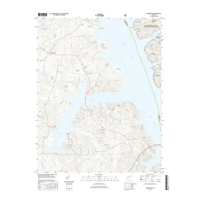
2016 Map of Fairdealing
USGS Topo · Published 2016About this map
Fairdealing and Aurora anchor this western Kentucky landscape, where the sprawling waters of Kentucky Lake dominate the terrain. This 2016 survey shows the intricate interface between the shoreline and the upland ridges, defined by a network of local roads like Hitte Rd and Union Ridge Rd. To the east, the Tennessee River channel is submerged beneath the lake, while the protected forests of Land Between The Lakes National Recreation Area line the far shore. For genealogists, the map is remarkably dense with family burial sites, including Price Cem, Collie Cem, Gregory Cem, and Hiatt Cem. The map also captures local infrastructure such as the Pirates Cove Airport and various drainage features like W Fork Bee Cr and Maple Spring Br that feed into the massive reservoir system.
Find a feature on this map
101 named features on this map. Tap any name to fly to it.
Don’t see what you’re looking for? This feature index may not catch every label — zoom into the map to look around manually.
Map Details
Editions of this 2016 Fairdealing Map
This is the sole edition of this map. No revisions or reprints were ever made.
Other maps of this area

1936 · Mont
USGS Topo · 1:24,000

1936 · Fenton
USGS Topo · 1:24,000

1936 · Hardin
USGS Topo · 1:24,000

1936 · Hiatt
USGS Topo · 1:24,000

1936 · Benton
USGS Topo · 1:48,000

1936 · Birmingham
USGS Topo · 1:24,000

1936 · Golden Pond
USGS Topo · 1:48,000

1936 · Rushing
USGS Topo · 1:24,000

1936 · Dexter
USGS Topo · 1:24,000

1936 · Hico
USGS Topo · 1:24,000