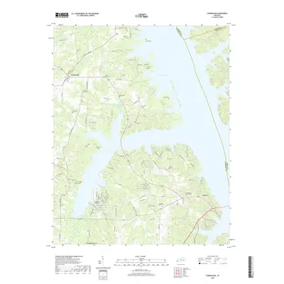
2019 Map of Fairdealing
USGS Topo · Published 2019About this map
Kentucky Lake dominates the eastern horizon of this Marshall County landscape, where the irregular shoreline creates deep inlets like Sugar Bay and Higgins Bay. The settlement of Fairdealing sits inland to the west, serving as a central point for a network of rural roads such as Old Olive Rd and Barge Island Rd. This area is characterized by numerous small drainages, including W Fork Bee Cr and Ruff Cr, which feed into the larger reservoir system.
Find a feature on this map
122 named features on this map. Tap any name to fly to it.
Don’t see what you’re looking for? This feature index may not catch every label — zoom into the map to look around manually.
Map Details
Editions of this 2019 Fairdealing Map
This is the sole edition of this map. No revisions or reprints were ever made.
Other maps of this area

1936 · Mont
USGS Topo · 1:24,000

1936 · Fenton
USGS Topo · 1:24,000

1936 · Hardin
USGS Topo · 1:24,000

1936 · Hiatt
USGS Topo · 1:24,000

1936 · Benton
USGS Topo · 1:48,000

1936 · Birmingham
USGS Topo · 1:24,000

1936 · Golden Pond
USGS Topo · 1:48,000

1936 · Rushing
USGS Topo · 1:24,000

1936 · Dexter
USGS Topo · 1:24,000

1936 · Hico
USGS Topo · 1:24,000