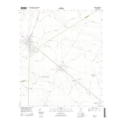
2014 Map of Fairfax
USGS Topo · Published 2014About this map
Fairfax and Brunson anchor this South Carolina landscape, where the local economy and settlement patterns are defined by a network of rural crossroads and river crossings. The terrain is marked by significant wetlands, most notably the wide reach of Caw Caw Swamp to the east and the Coosawhatchie River which flows through the southern portion of the quadrangle. Historic named junctions like Richardson Crossroads and Brandon Crossing reflect a long-standing agricultural and transportation grid that connects smaller hamlets such as Dukes and Pond Town. Along the corridor between the primary towns, smaller landmarks like Halls Mill and Lovetts Crossing provide specific points of interest for those tracing family history or local land use. The presence of Rail Road Ave in Brunson and the naming of local routes like Old Salkehatchie Hwy and Buford's Bridge Hwy suggest the importance of these thoroughfares in the region's development.
Find a feature on this map
81 named features on this map. Tap any name to fly to it.
Don’t see what you’re looking for? This feature index may not catch every label — zoom into the map to look around manually.
Map Details
Editions of this 2014 Fairfax Map
This is the sole edition of this map. No revisions or reprints were ever made.
Other maps of this area

1918 · Varnville
USGS Topo · 1:62,500

1919 · Olar
USGS Topo · 1:62,500

1919 · Allendale
USGS Topo · 1:62,500

1920 · Peeples
USGS Topo · 1:62,500

1943 · Olar
USGS Topo · 1:62,500

1943 · Allendale
USGS Topo · 1:62,500

1943 · Peeples
USGS Topo · 1:62,500

1944 · Varnville
USGS Topo · 1:62,500

1947 · Savannah
USGS Topo · 1:250,000

1948 · Savannah
USGS Topo · 1:250,000