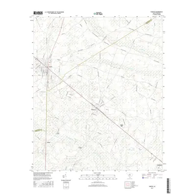
2017 Map of Fairfax
USGS Topo · Published 2017About this map
The Fairfax and Brunson corridor is defined by a dense network of local roads and watercourses crossing the boundary between Allendale and Hampton counties. Residential streets in Fairfax, such as Sumter Ave and Laurens Ave, contrast with the rural expanses to the east where the Coosawhatchie River and Blood Hill Cr meander through low-lying wetlands. Historically significant transport points appear as river and rail crossings, including Lovetts Crossing and Brandon Crossing, suggesting a landscape shaped by both the railroad and the hydraulic network of the Caw Caw Swamp. Rural life is anchored by family and community landmarks like Mt Pleasant Church Rd, while smaller named settlements such as Dukes and the site of Halls Mill provide a detailed look at the localized geography of the South Carolina Lowcountry.
Find a feature on this map
93 named features on this map. Tap any name to fly to it.
Don’t see what you’re looking for? This feature index may not catch every label — zoom into the map to look around manually.
Map Details
Editions of this 2017 Fairfax Map
This is the sole edition of this map. No revisions or reprints were ever made.
Other maps of this area

1918 · Varnville
USGS Topo · 1:62,500

1919 · Olar
USGS Topo · 1:62,500

1919 · Allendale
USGS Topo · 1:62,500

1920 · Peeples
USGS Topo · 1:62,500

1943 · Olar
USGS Topo · 1:62,500

1943 · Allendale
USGS Topo · 1:62,500

1943 · Peeples
USGS Topo · 1:62,500

1944 · Varnville
USGS Topo · 1:62,500

1947 · Savannah
USGS Topo · 1:250,000

1948 · Savannah
USGS Topo · 1:250,000