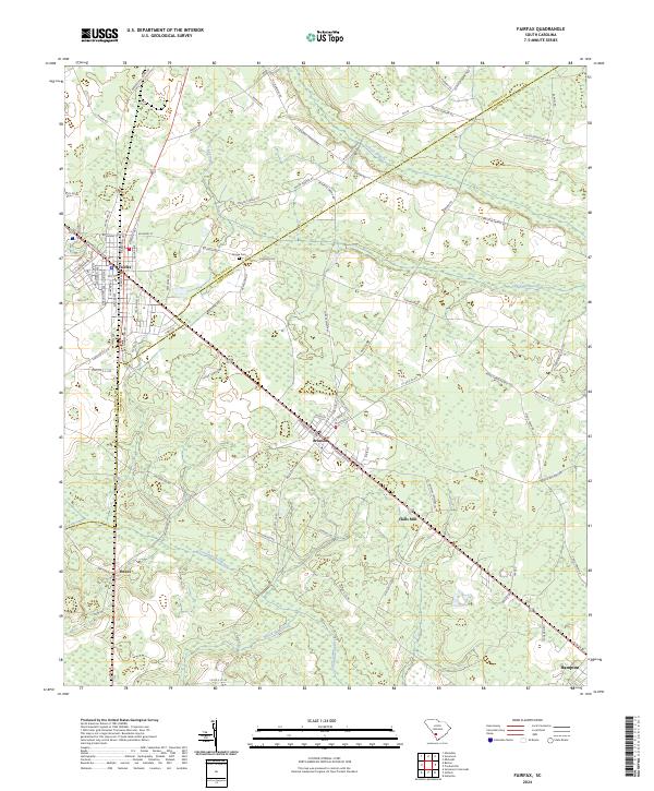
2024 Map of Fairfax
USGS Topo · Published 2024About this map
The Allendale Co Hampton Co boundary divides this landscape, where the agricultural and timber roots of the South Carolina Lowcountry remain visible. The rail-aligned settlements of Fairfax and Brunson anchor the region, connected by a corridor that runs parallel to Railroad Ave SW. The industrial history of the area is hinted at by features like Turpentine Still Rd and Halls Mill, suggesting a landscape once defined by naval stores and local milling.
Find a feature on this map
87 named features on this map. Tap any name to fly to it.
Don’t see what you’re looking for? This feature index may not catch every label — zoom into the map to look around manually.
Map Details
Editions of this 2024 Fairfax Map
This is the sole edition of this map. No revisions or reprints were ever made.
Other maps of this area

1918 · Varnville
USGS Topo · 1:62,500

1919 · Olar
USGS Topo · 1:62,500

1919 · Allendale
USGS Topo · 1:62,500

1920 · Peeples
USGS Topo · 1:62,500

1943 · Olar
USGS Topo · 1:62,500

1943 · Allendale
USGS Topo · 1:62,500

1943 · Peeples
USGS Topo · 1:62,500

1944 · Varnville
USGS Topo · 1:62,500

1947 · Savannah
USGS Topo · 1:250,000

1948 · Savannah
USGS Topo · 1:250,000