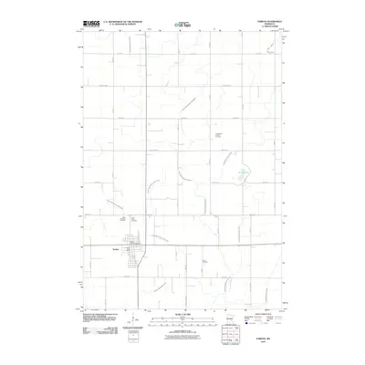
2010 Map of Fairfax
USGS Topo · Published 2010About this map
Fairfax serves as the central hub of this agricultural landscape in Renville County, where a grid of rural roads connects scattered farms to the town center and the Fairfax Post Office. The surrounding prairie is defined by an extensive network of water management features, including County Ditch Number Thirtyfour and Judicial Ditch Number Eight, which drain the land toward small water bodies like Round Lake. This drainage system is a hallmark of the region's intensive farming history, shaping how the land was settled and cultivated. For those tracing family history, several burial grounds are preserved across the township, including the Evangelical Lutheran Cemetery, Saint Andrews Cemetery, Saint Johns Cemetery, and Cairo Cemetery. Near the town limits, the Valley View Campgrounds offers a point of local recreation amidst the productive fields.
Find a feature on this map
25 named features on this map. Tap any name to fly to it.
Don’t see what you’re looking for? This feature index may not catch every label — zoom into the map to look around manually.
Map Details
Editions of this 2010 Fairfax Map
This is the sole edition of this map. No revisions or reprints were ever made.
Other maps of this area

1952 · Morton
USGS Topo · 1:62,500

1953 · Morgan
USGS Topo · 1:62,500

1953 · New Ulm
USGS Topo · 1:250,000

1957 · New Ulm
USGS Topo · 1:250,000

1958 · New Ulm
USGS Topo · 1:250,000

1964 · Fairfax
USGS Topo · 1:24,000

1964 · Sleepy Eye NW
USGS Topo · 1:24,000

1964 · Buffalo Lake
USGS Topo · 1:24,000

1964 · Hector
USGS Topo · 1:24,000

1964 · St George
USGS Topo · 1:24,000