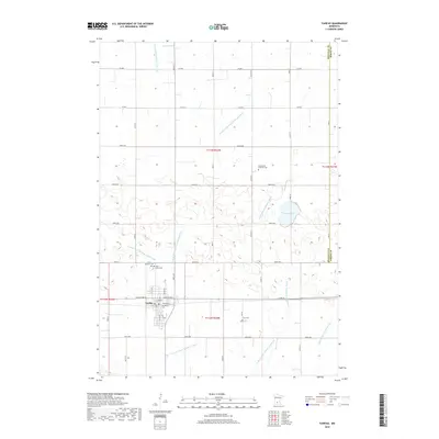
2019 Map of Fairfax
USGS Topo · Published 2019About this map
Fairfax anchors the southwestern portion of this prairie landscape, serving as a hub for the surrounding agricultural community along the border of Renville and Sibley counties. The town's layout is defined by a traditional grid oriented toward Lincoln Ave W and Lincoln Ave E. Local heritage is preserved in several nearby burial grounds, including Saint Andrews Cem, Saint Johns Cem, and the Cairo Cem located to the east.
Find a feature on this map
33 named features on this map. Tap any name to fly to it.
Don’t see what you’re looking for? This feature index may not catch every label — zoom into the map to look around manually.
Map Details
Editions of this 2019 Fairfax Map
This is the sole edition of this map. No revisions or reprints were ever made.
Other maps of this area

1952 · Morton
USGS Topo · 1:62,500

1953 · Morgan
USGS Topo · 1:62,500

1953 · New Ulm
USGS Topo · 1:250,000

1957 · New Ulm
USGS Topo · 1:250,000

1958 · New Ulm
USGS Topo · 1:250,000

1964 · Fairfax
USGS Topo · 1:24,000

1964 · Sleepy Eye NW
USGS Topo · 1:24,000

1964 · Buffalo Lake
USGS Topo · 1:24,000

1964 · Hector
USGS Topo · 1:24,000

1964 · St George
USGS Topo · 1:24,000