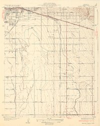
1932 Map of Fairfax School
USGS Topo · Published 1932About this map
Agricultural development and early irrigation systems define this landscape southeast of Bakersfield in the southern San Joaquin Valley. The map captures the transition from open terrain into an organized grid of ranch roads and canals, such as the Tehachapi Canal and Weed Patch Canal, which supported the growing farming communities of Magunden and Lamont. Educational hubs are prominent throughout the rural landscape, including the eponymous Fairfax School, Brundage Sch, and Mountain View Sch.
Find a feature on this map
41 named features on this map. Tap any name to fly to it.
Don’t see what you’re looking for? This feature index may not catch every label — zoom into the map to look around manually.
Map Details
Editions of this 1932 Fairfax School Map
3 editions found

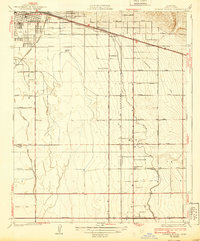
Other maps of this area

1906 · Bakersfield
USGS Topo · 1:62,500

1910 · Buena Vista Lake
USGS Topo · 1:125,000

1912 · Buena Vista Lake
USGS Topo · 1:125,000

1914 · Caliente
USGS Topo · 1:125,000

1929 · Fairfax School
USGS Topo · 1:31,680

1930 · Weed Patch
USGS Topo · 1:31,680

1930 · Arvin
USGS Topo · 1:31,680

1930 · Conner
USGS Topo · 1:31,680

1930 · Oildale
USGS Topo · 1:31,680

1931 · Edison
USGS Topo · 1:31,680