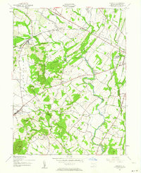
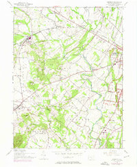
1951 Map of Fairfield
USGS Topo · Published 1965About this map
The western edges of the Gettysburg battlefield and the surrounding Adams County countryside define this 1951 topographic survey. To the east, the boundaries of the Gettysburg National Military Park encompass the famous slopes of Herr Ridge, while the Western Maryland rail line cuts across the northern landscape through McKnightstown and Orrtanna. This era shows a densely settled rural network of family-named schools and churches that anchored local life before the consolidation of the mid-20th century.
Find a feature on this map
50 named features on this map. Tap any name to fly to it.
Don’t see what you’re looking for? This feature index may not catch every label — zoom into the map to look around manually.
Map Details
Editions of this 1951 Fairfield Map
7 editions found
Other maps of this area

1908 · Gettysburg
USGS Topo · 1:62,500

1909 · Fairfield
USGS Topo · 1:62,500

1911 · Taneytown
USGS Topo · 1:62,500

1911 · Emmitsburg
USGS Topo · 1:62,500

1942 · Gettysburg
USGS Topo · 1:125,000

1943 · Emmitsburg
USGS Topo · 1:62,500

1944 · Gettysburg
USGS Topo · 1:31,680

1944 · Flat Ridge
USGS Topo · 1:31,680
1944 · Blue Ridge Summit
USGS Topo · 1:31,680

1944 · Arendtsville
USGS Topo · 1:31,680
Featured Places
- Fairfield, PA
- Franklin Township, PA
- Hamiltonban Township, PA
- Cumberland Township, PA
- Liberty Township, PA