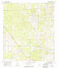
1968 Map of Fairfield
USGS Topo · Published 1986About this map
Blitchton and the northern settlement of Fairfield anchor this rural landscape in Marion County, surveyed in the late 1960s. The region is marked by numerous limestone or phosphate Quarry operations, indicating a landscape defined by local extraction and rolling topography. Transportation patterns are anchored by an Old Railroad Grade that cuts across the terrain, reflecting the evolution of local transit.
Find a feature on this map
19 named features on this map. Tap any name to fly to it.
Don’t see what you’re looking for? This feature index may not catch every label — zoom into the map to look around manually.
Map Details
Editions of this 1968 Fairfield Map
3 editions found
Other maps of this area

1892 · Dunnellon
USGS Topo · 1:62,500

1893 · Citra
USGS Topo · 1:62,500

1894 · Dunnellon
USGS Topo · 1:62,500

1895 · Williston
USGS Topo · 1:62,500

1895 · Citra
USGS Topo · 1:62,500

1895 · Ocala
USGS Topo · 1:62,500

1954 · Romeo
USGS Topo · 1:24,000

1954 · Cotton Plant
USGS Topo · 1:24,000

1954 · Dunnellon
USGS Topo · 1:62,500

1954 · Gainesville
USGS Topo · 1:250,000