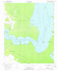
1953 Map of Fairfield NE
USGS Topo · Published 1977About this map
The Alligator River serves as the dominant geographic spine of this coastal landscape, where the borders of Tyrrell, Dare, and Hyde counties converge amidst an intricate network of marshes and bays. The map reveals the low-lying terrain of Gum Neck and Buck Island, punctuated by small maritime outposts like Gum Neck Landing and Grapevine Landing. These points of access were critical for the local economy and movement before modern infrastructure fully penetrated the wetlands.
Find a feature on this map
35 named features on this map. Tap any name to fly to it.
Don’t see what you’re looking for? This feature index may not catch every label — zoom into the map to look around manually.
Map Details
Editions of this 1953 Fairfield NE Map
3 editions found
Other maps of this area

1943 · Columbia
USGS Topo · 1:125,000

1943 · Roanoke Island
USGS Topo · 1:125,000

1951 · Engelhard West
USGS Topo · 1:24,000

1951 · Engelhard East
USGS Topo · 1:24,000

1951 · Fairfield
USGS Topo · 1:24,000

1953 · Engelhard NW
USGS Topo · 1:24,000

1953 · Buffalo City
USGS Topo · 1:24,000

1953 · Fairfield NE
USGS Topo · 1:24,000

1953 · Scotia
USGS Topo · 1:24,000

1953 · Frying Pan
USGS Topo · 1:24,000