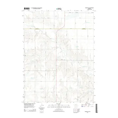
2014 Map of Fairfield SE
USGS Topo · Published 2014About this map
The Little Blue River carves a winding path across the border of Clay and Nuckolls Counties, defining a landscape of agricultural drainage and water management. This area is characterized by a series of engineered water bodies named for local figures, such as Mazour Reservoir, Jones Reservoir, and the Whithorn-Brown Reservoir. These features, alongside the natural flow of Buffalo Cr and Walnut Cr, illustrate the region's reliance on harnessed water resources for its prairie economy. Local genealogy is anchored by well-dispersed rural burial sites, including Pleasant Hill Cem to the west and Oxbow Cem near Oxbow Cr in the southeast. The sectioned grid of roads, such as Road 301 and Ne-14, underscores the disciplined township-and-range surveying that has dictated land use and property boundaries in this part of Nebraska for generations.
Find a feature on this map
40 named features on this map. Tap any name to fly to it.
Don’t see what you’re looking for? This feature index may not catch every label — zoom into the map to look around manually.
Map Details
Editions of this 2014 Fairfield SE Map
This is the sole edition of this map. No revisions or reprints were ever made.
Other maps of this area

1898 · Superior
USGS Topo · 1:125,000

1898 · Hebron
USGS Topo · 1:125,000

1955 · Lincoln
USGS Topo · 1:250,000

1955 · Grand Island
USGS Topo · 1:250,000

1957 · Lincoln
USGS Topo · 1:250,000

1957 · Grand Island
USGS Topo · 1:250,000

1958 · Grand Island
USGS Topo · 1:250,000

1958 · Lincoln
USGS Topo · 1:250,000

1960 · Edgar
USGS Topo · 1:24,000
1960 · Fairfield SE
USGS Topo · 1:24,000