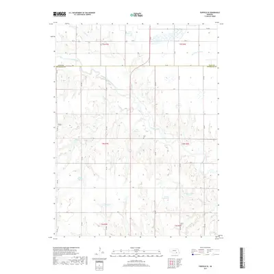
2017 Map of Fairfield SE
USGS Topo · Published 2017About this map
The Little Blue River winds through this rural landscape on the border of Clay and Nuckolls counties, defining the agricultural character of south-central Nebraska. This 2017 survey reveals a terrain shaped by water management, with numerous family-named landmarks such as Jones Reservoir, Wroughton Reservoir, and Hoyt Reservoir dotting the sections. These features, alongside creek systems like Buffalo Cr and Oxbow Cr, illustrate how modern landowners have modified the prairie for local irrigation and livestock. For those researching family history in this part of the state, several rural burial sites are documented in their original context, including Pleasant Hill Cem, Smith Cem, and Oxbow Cem, which remain as quiet landmarks among the surveyed roads and township lines.
Find a feature on this map
33 named features on this map. Tap any name to fly to it.
Don’t see what you’re looking for? This feature index may not catch every label — zoom into the map to look around manually.
Map Details
Editions of this 2017 Fairfield SE Map
This is the sole edition of this map. No revisions or reprints were ever made.
Other maps of this area

1898 · Superior
USGS Topo · 1:125,000

1898 · Hebron
USGS Topo · 1:125,000

1955 · Lincoln
USGS Topo · 1:250,000

1955 · Grand Island
USGS Topo · 1:250,000

1957 · Lincoln
USGS Topo · 1:250,000

1957 · Grand Island
USGS Topo · 1:250,000

1958 · Grand Island
USGS Topo · 1:250,000

1958 · Lincoln
USGS Topo · 1:250,000

1960 · Edgar
USGS Topo · 1:24,000
1960 · Fairfield SE
USGS Topo · 1:24,000