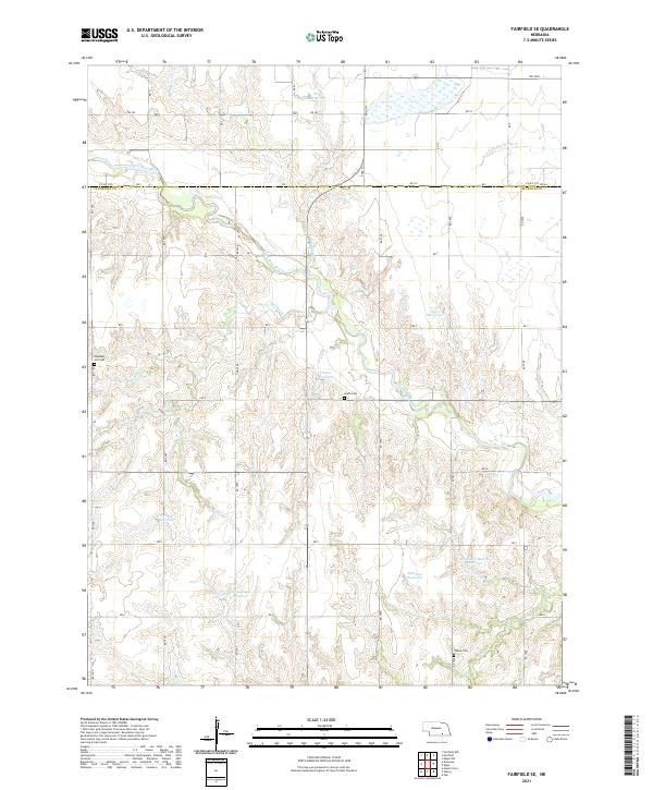
2021 Map of Fairfield SE
USGS Topo · Published 2021About this map
The Little Blue River winds through this section of the Nebraska plains, creating a riparian corridor that breaks the grid of agricultural land and section roads. This 2021 landscape across Clay Co and Nuckolls Co is defined by a sophisticated system of water management, visible in the numerous reservoirs scattered throughout the townships. Local heritage is preserved in quiet landmarks such as Pleasant Hill Cem, Smith Cem, and Oxbow Cem, which serve as anchors for the rural communities. The drainage network, featuring Walnut Cr, Buffalo Cr, and Oxbow Cr, directs the flow toward the main river valley, while named impoundments like Jones Reservoir and Whithorn-Brown Reservoir illustrate the modern agricultural engineering required to sustain this productive prairie environment.
Find a feature on this map
34 named features on this map. Tap any name to fly to it.
Don’t see what you’re looking for? This feature index may not catch every label — zoom into the map to look around manually.
Map Details
Editions of this 2021 Fairfield SE Map
This is the sole edition of this map. No revisions or reprints were ever made.
Other maps of this area

1898 · Superior
USGS Topo · 1:125,000

1898 · Hebron
USGS Topo · 1:125,000

1955 · Lincoln
USGS Topo · 1:250,000

1955 · Grand Island
USGS Topo · 1:250,000

1957 · Lincoln
USGS Topo · 1:250,000

1957 · Grand Island
USGS Topo · 1:250,000

1958 · Grand Island
USGS Topo · 1:250,000

1958 · Lincoln
USGS Topo · 1:250,000

1960 · Edgar
USGS Topo · 1:24,000
1960 · Fairfield SE
USGS Topo · 1:24,000