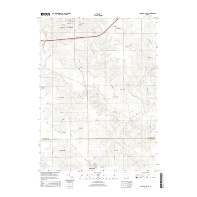
2015 Map of Fairfield South
USGS Topo · Published 2015About this map
Fairfield and its southern agricultural hinterland unfold across this Jefferson and Van Buren County borderland. The landscape is defined by the winding course of Cedar Creek, which carves through the central terrain, and the smaller Troy Cr and Little Cr watersheds. Local family heritage is preserved in numerous rural burial grounds, including the Gallaher Family Cem and the Clinkenbeard Family Cem. At the southern edge of the survey, the village of Birmingham appears at a crossroads, serving as a hub for the surrounding farmsteads. The presence of the County Poor Farm Cem west of Cedar Creek provides a poignant geographic link to the county's social history and the 19th-century systems of local charity and land-use. The map captures the rectilinear grid of township boundaries, such as t71n r9w, meeting the organic drainage patterns of the Iowa countryside.
Find a feature on this map
102 named features on this map. Tap any name to fly to it.
Don’t see what you’re looking for? This feature index may not catch every label — zoom into the map to look around manually.
Map Details
Editions of this 2015 Fairfield South Map
This is the sole edition of this map. No revisions or reprints were ever made.
Other maps of this area

1954 · Centerville
USGS Topo · 1:250,000

1954 · Des Moines
USGS Topo · 1:250,000

1956 · Des Moines
USGS Topo · 1:250,000

1957 · Des Moines
USGS Topo · 1:250,000

1957 · Centerville
USGS Topo · 1:250,000

1958 · Centerville
USGS Topo · 1:250,000

1958 · Burlington
USGS Topo · 1:250,000

1958 · Davenport
USGS Topo · 1:250,000

1961 · Burlington
USGS Topo · 1:250,000

1961 · Davenport
USGS Topo · 1:250,000