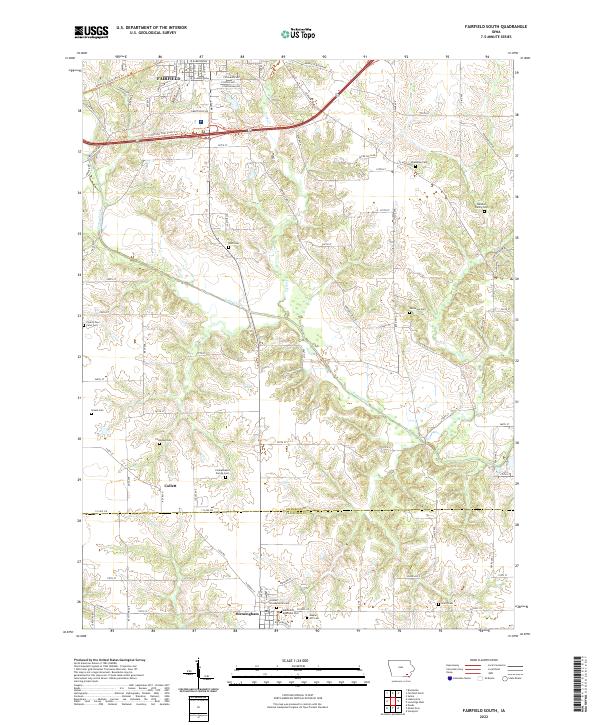
2022 Map of Fairfield South
USGS Topo · Published 2022About this map
Birmingham and Collett anchor the southern landscape of Jefferson County, where the terrain is defined by the winding course of Cedar Creek. This area shows a dense concentration of historical burial sites, including family plots like the Galliher Family Cem and the Clinkenbeard Family Cem, which offer significant value for genealogical research. Further north, the southern edges of Fairfield transition into more rural acreage, marked by the County Poor Farm Cem and Steele Cem. The map reveals an intricate network of local roads such as New Glasgow Rd and Libertyville Rd that connect these small rural communities. In the town of Birmingham, religious and social history is grounded by the United Presbyterian Cem and the Methodist Episcopal Cem, reflecting the early spiritual centers of the township.
Find a feature on this map
63 named features on this map. Tap any name to fly to it.
Don’t see what you’re looking for? This feature index may not catch every label — zoom into the map to look around manually.
Map Details
Editions of this 2022 Fairfield South Map
This is the sole edition of this map. No revisions or reprints were ever made.
Other maps of this area

1954 · Centerville
USGS Topo · 1:250,000

1954 · Des Moines
USGS Topo · 1:250,000

1956 · Des Moines
USGS Topo · 1:250,000

1957 · Des Moines
USGS Topo · 1:250,000

1957 · Centerville
USGS Topo · 1:250,000

1958 · Centerville
USGS Topo · 1:250,000

1958 · Burlington
USGS Topo · 1:250,000

1958 · Davenport
USGS Topo · 1:250,000

1961 · Burlington
USGS Topo · 1:250,000

1961 · Davenport
USGS Topo · 1:250,000