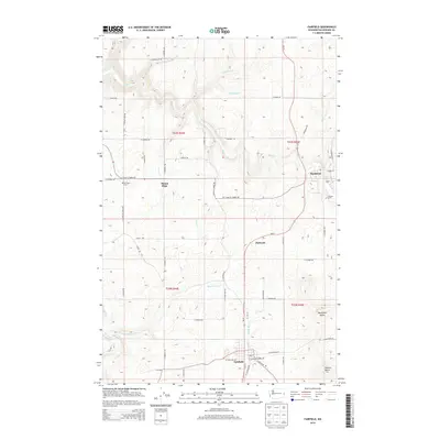
2014 Map of Fairfield
USGS Topo · Published 2014About this map
Fairfield anchors the southern portion of this landscape, where the local street grid including W Portland Ave and E Main St meets the winding path of Rattler Run Cr. The terrain is defined by prominent elevations like Hansen Butte and Morefield Butte, which overlook a network of agricultural roads and drainage systems. Moving north, the map traces the early 21st-century footprints of Rockford and the smaller settlement of Darknell, connected by a web of rural routes such as S Marsh Rd and S Campbell Rd.
Find a feature on this map
58 named features on this map. Tap any name to fly to it.
Don’t see what you’re looking for? This feature index may not catch every label — zoom into the map to look around manually.
Map Details
Editions of this 2014 Fairfield Map
This is the sole edition of this map. No revisions or reprints were ever made.
Other maps of this area

1901 · Spokane
USGS Topo · 1:125,000

1903 · Oakesdale
USGS Topo · 1:125,000

1905 · Oakesdale
USGS Topo · 1:125,000

1949 · Greenacres
USGS Topo · 1:62,500

1950 · Spokane SE
USGS Topo · 1:24,000

1950 · Spokane
USGS Topo · 1:62,500

1951 · Greenacres
USGS Topo · 1:62,500

1954 · Spangle
USGS Topo · 1:62,500

1954 · Fairfield
USGS Topo · 1:62,500

1955 · Spokane
USGS Topo · 1:250,000