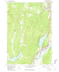
1981 Map of Fairlee
USGS Topo · Published 1981About this map
The Connecticut River serves as the state line between Vermont and New Hampshire on this 1981 survey, defining the eastern corridor where transport and recreation converge. In Fairlee, the landscape transitions from the aquatic recreation of Lake Morey and its surrounding Golf Course to the sheer verticality of The Palisades. This era shows a community balanced between rural utility and leisure, featuring the Bear Ridge Raceway near Bradford and a Drive-in Theater across the river in Orford.
Find a feature on this map
54 named features on this map. Tap any name to fly to it.
Don’t see what you’re looking for? This feature index may not catch every label — zoom into the map to look around manually.
Map Details
Editions of this 1981 Fairlee Map
3 editions found
Other maps of this area

1896 · Strafford
USGS Topo · 1:62,500

1931 · Mt. Cube
USGS Topo · 1:62,500

1931 · Woodsville
USGS Topo · 1:48,000

1933 · Mt. Cube
USGS Topo · 1:62,500

1935 · Woodsville
USGS Topo · 1:62,500

1941 · Woodsville
USGS Topo · 1:62,500

1944 · Strafford
USGS Topo · 1:62,500

1947 · Corinth
USGS Topo · 1:62,500

1948 · East Barre
USGS Topo · 1:62,500

1950 · Glens Falls
USGS Topo · 1:250,000