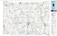
1985 Map of Fairmont
USGS Topo · Published 1991About this map
Fairmont serves as the focal point of this Southern Minnesota prairie landscape, where a chain of interconnected water bodies including Budd Lake, Hall Lake, and Sisseton Lake create a distinct geographic center. The region is defined by its deep agricultural roots and a sophisticated network of transportation, most notably the Chicago & North Western railroad which connects agrarian hubs like St James, Trimont, and Blue Earth. Numerous state wildlife management areas, such as Armbrust State Wildlife Management Area and Ceylon State Wildlife Management Area, are scattered throughout the quadrangle, indicating a landscape managed for conservation amidst intensive farming. The map also captures the interstate development of Interstate 90 as it traverses the county, cutting through townships like Rolling Green and Manyaska while skirting the shores of Fox Lake.
Find a feature on this map
150 named features on this map. Tap any name to fly to it.
Don’t see what you’re looking for? This feature index may not catch every label — zoom into the map to look around manually.
Map Details
Editions of this 1985 Fairmont Map
This is the sole edition of this map. No revisions or reprints were ever made.
Other maps of this area

1950 · Mankato East
USGS Topo · 1:62,500

1951 · Mankato East
USGS Topo · 1:62,500

1951 · Mankato West
USGS Topo · 1:62,500

1953 · Saint Paul
USGS Topo · 1:250,000

1953 · New Ulm
USGS Topo · 1:250,000

1954 · Fairmont
USGS Topo · 1:250,000

1954 · Mason City
USGS Topo · 1:250,000

1955 · Bricelyn
USGS Topo · 1:62,500

1957 · New Ulm
USGS Topo · 1:250,000

1957 · Mason City
USGS Topo · 1:250,000