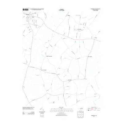
2013 Map of Fairmont
USGS Topo · Published 2013About this map
Fairmont serves as the primary hub in this portion of Robeson County, where a dense network of local streets like Pittman St and S Morro St gives way to a landscape defined by an intricate drainage system. The terrain is dominated by the sprawling reaches of Big Indian Swamp, Little Indian Swamp, and Indian Swamp, which dictate the placement of rural crossroads and agriculture. In the early 21st century, aviation infrastructure is prominent with McKee Airport to the north and Mynatt Field Airport further south near Barnesville. Small, distinct communities such as Proctorville, Orrum, and Bloomingdale are linked by long-established routes like Old Stage Rd. This survey captures the transition from the concentrated grid of Fairmont to the water-rich lowlands bordering the Lumber River, highlighting how the natural hydrology of Miry Branch and Gin Branch has influenced the development of Leggett Crossroads and Ivey Crossroads.
Find a feature on this map
100 named features on this map. Tap any name to fly to it.
Don’t see what you’re looking for? This feature index may not catch every label — zoom into the map to look around manually.
Map Details
Editions of this 2013 Fairmont Map
This is the sole edition of this map. No revisions or reprints were ever made.
Other maps of this area

1943 · Pages Mill
USGS Topo · 1:62,500

1953 · Chadbourn
USGS Topo · 1:62,500

1953 · Florence
USGS Topo · 1:250,000

1954 · Florence
USGS Topo · 1:250,000

1957 · Bladenboro
USGS Topo · 1:62,500

1962 · Fair Bluff
USGS Topo · 1:24,000

1962 · Fairmont
USGS Topo · 1:24,000

1962 · Lake View
USGS Topo · 1:24,000

1962 · Gaddysville
USGS Topo · 1:24,000

1962 · Fair Bluff
USGS Topo · 1:62,500