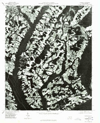
1976 Map of Fairmont
USGS Topo · Published 1978About this map
Fairmont stands as a primary hub of development in this mid-1970s orthophotograph, surrounded by the distinctive patchwork of agricultural fields and dense woodlands of Robeson County. The image provides a rare visual of the rural landscape before more modern encroachment, showing the established communities of Proctorville and Orrum connected by a network of local roads. The dark, meandering path of the Lumber river or swamp system cuts a sharp contrast against the cleared farmland, dictating the settlement patterns and roadway alignments of the era. Smaller rural junctions like Leggett Crossroads reflect the local economy’s reliance on these intersections as community anchors. This aerial perspective allows for a clear examination of land use and property boundaries as they existed during this bicentennial period.
Find a feature on this map
5 named features on this map. Tap any name to fly to it.
Don’t see what you’re looking for? This feature index may not catch every label — zoom into the map to look around manually.
Map Details
Editions of this 1976 Fairmont Map
This is the sole edition of this map. No revisions or reprints were ever made.
Other maps of this area

1943 · Pages Mill
USGS Topo · 1:62,500

1953 · Chadbourn
USGS Topo · 1:62,500

1953 · Florence
USGS Topo · 1:250,000

1954 · Florence
USGS Topo · 1:250,000

1957 · Bladenboro
USGS Topo · 1:62,500

1962 · Fair Bluff
USGS Topo · 1:24,000

1962 · Fairmont
USGS Topo · 1:24,000

1962 · Lake View
USGS Topo · 1:24,000

1962 · Gaddysville
USGS Topo · 1:24,000

1962 · Fair Bluff
USGS Topo · 1:62,500