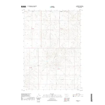
2017 Map of Fairpoint
USGS Topo · Published 2017About this map
Fairpoint anchors this western South Dakota landscape, serving as a primary point of reference in a region defined by expansive prairie and drainage systems. The small community is situated at the junction of Co Hwy Mc 23 and W Fairpoint Rd, where local life is centered around the Fairpoint Cem. The topography is marked by the winding path of Coyote Cr, which meanders across the central and southern sections of the quadrangle. Sparse road networks like Atall Rd and Minnehaha Pl indicate the remote, rural nature of Meade County during this period. The survey provides a clear view of the Public Land Survey System divisions, including t9n r11e and t8n r11e, illustrating how the land was partitioned for ranching and settlement.
Find a feature on this map
11 named features on this map. Tap any name to fly to it.
Don’t see what you’re looking for? This feature index may not catch every label — zoom into the map to look around manually.
Map Details
Editions of this 2017 Fairpoint Map
This is the sole edition of this map. No revisions or reprints were ever made.
Other maps of this area

1953 · Rapid City
USGS Topo · 1:250,000

1957 · Rapid City
USGS Topo · 1:250,000

1959 · Fairpoint
USGS Topo · 1:24,000

1959 · Fairpoint SW
USGS Topo · 1:24,000

1959 · Stoneville
USGS Topo · 1:24,000

1959 · Union Center
USGS Topo · 1:24,000

1959 · Fairpoint NW
USGS Topo · 1:24,000
1959 · Fairpoint SE
USGS Topo · 1:24,000

1977 · Table Top Butte
USGS Topo · 1:24,000

1978 · Bull Run Creek
USGS Topo · 1:24,000