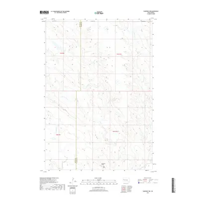
2017 Map of Fairpoint NW
USGS Topo · Published 2017About this map
Elm Butte and the Elm Butte Divide anchor this high-plains landscape where the border between Butte and Meade counties is defined by a straight-line survey through the grasslands. The drainage pattern is the dominant physical feature of the region, characterized by the winding paths of Elm Creek, Soft Water Creek, and Crooked Elm Creek. These waterways create a network of draws and ridges that dictated the placement of early travel routes. Human infrastructure is sparse, concentrated primarily along the northern edge of the sheet where Fair Point Road and West Fairpoint Road provide access across the township lines. This 2017 survey reflects a largely unchanged rural environment, preserved as open range and divided by the traditional section lines of the Public Land Survey System.
Find a feature on this map
12 named features on this map. Tap any name to fly to it.
Don’t see what you’re looking for? This feature index may not catch every label — zoom into the map to look around manually.
Map Details
Editions of this 2017 Fairpoint NW Map
This is the sole edition of this map. No revisions or reprints were ever made.
Other maps of this area

1913 · Newell
USGS Topo · 1:125,000

1951 · Volunteer SE
USGS Topo · 1:24,000

1953 · Rapid City
USGS Topo · 1:250,000

1957 · Rapid City
USGS Topo · 1:250,000

1959 · Fairpoint
USGS Topo · 1:24,000

1959 · Fairpoint SW
USGS Topo · 1:24,000
1959 · Volunteer NE
USGS Topo · 1:24,000

1959 · Fairpoint NW
USGS Topo · 1:24,000
1959 · Fairpoint SE
USGS Topo · 1:24,000

1977 · Table Top Butte
USGS Topo · 1:24,000