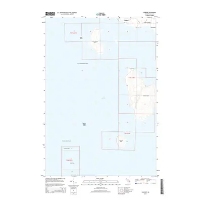
2014 Map of Fairport
USGS Topo · Published 2014About this map
Fairport stands at the southern tip of the Garden Peninsula in Delta County, serving as the northern gateway to an archipelago stretching into Lake Michigan. This 2014 survey details the complex maritime geography of the Green Bay entrance, including Summer Island and Little Summer Island. The landscape is defined by its dramatic points and dangerous shallows, from the rocky protrusion of Point Detour to the submerged hazards of Little Summer Island Shoal and Poverty Island Shoal. Further south, the map tracks the chain of smaller landmasses like Poverty Island, Gravelly Island, and Gull Island. The limited road network, consisting of Ii RD and B.25 LN, underscores the isolated character of this coastal community, where the topography of the islands remains largely undeveloped, preserving the original township and range divisions of the nineteenth-century land surveys.
Find a feature on this map
22 named features on this map. Tap any name to fly to it.
Don’t see what you’re looking for? This feature index may not catch every label — zoom into the map to look around manually.
Map Details
Editions of this 2014 Fairport Map
This is the sole edition of this map. No revisions or reprints were ever made.
Other maps of this area

1932 · Burnt Bluff SW
USGS Topo · 1:31,680

1932 · Burnt Bluff NE
USGS Topo · 1:31,680

1932 · Burnt Bluff NW
USGS Topo · 1:31,680

1954 · Escanaba
USGS Topo · 1:250,000

1957 · Escanaba
USGS Topo · 1:250,000

1958 · Escanaba
USGS Topo · 1:250,000

1958 · Peninsula Point
USGS Topo · 1:62,500

1958 · Fairport
USGS Topo · 1:62,500

1960 · Washington Island
USGS Topo · 1:62,500

1982 · Washington Island NE
USGS Topo · 1:24,000