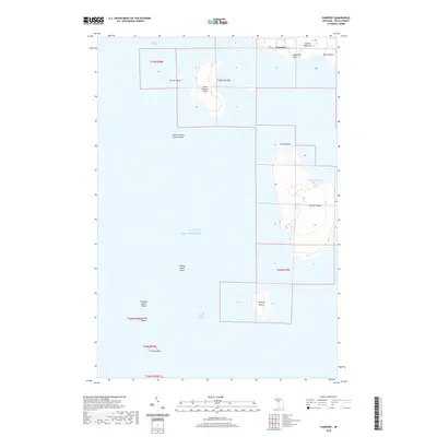
2019 Map of Fairport
USGS Topo · Published 2019About this map
Fairport sits at the southern tip of the Garden Peninsula, serving as a gateway to a chain of islands separating Big Bay de Noc from the wider waters of Green Bay. The landscape is dominated by these maritime passages and landforms, including Point Detour and Anderson Point which frame the northern coastline. Extending southward into the lake, a series of significant islands including Summer Island, Little Summer Island, and Poverty Island create a complex navigational environment. The presence of Summer Harbor on the eastern side of Summer Island and various shoals, such as Gravelly Island Shoals, indicates the maritime hazards and natural shelters that have long shaped local life. These island chains and the Poverty Island Passage reflect the isolation and unique geography of this part of Delta County.
Find a feature on this map
23 named features on this map. Tap any name to fly to it.
Don’t see what you’re looking for? This feature index may not catch every label — zoom into the map to look around manually.
Map Details
Editions of this 2019 Fairport Map
This is the sole edition of this map. No revisions or reprints were ever made.
Other maps of this area

1932 · Burnt Bluff SW
USGS Topo · 1:31,680

1932 · Burnt Bluff NE
USGS Topo · 1:31,680

1932 · Burnt Bluff NW
USGS Topo · 1:31,680

1954 · Escanaba
USGS Topo · 1:250,000

1957 · Escanaba
USGS Topo · 1:250,000

1958 · Escanaba
USGS Topo · 1:250,000

1958 · Peninsula Point
USGS Topo · 1:62,500

1958 · Fairport
USGS Topo · 1:62,500

1960 · Washington Island
USGS Topo · 1:62,500

1982 · Washington Island NE
USGS Topo · 1:24,000