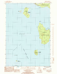
1985 Map of Fairport
USGS Topo · Published 1985About this map
Fairport sits at the southern tip of the Garden Peninsula, serving as the gateway to a chain of islands that separate Lake Michigan from Green Bay. In the mid-1980s, this area remained largely dominated by the Lake Superior State Forest, which covers significant portions of Summer Island and Poverty Island. The map details the intricate maritime environment of the Poverty Island Passage, a critical waterway for vessels navigating the upper Great Lakes. Further south, smaller landforms like Gull Island and Little Gull Island mark the boundary of Fairbanks Township. Along the eastern shore of Summer Island, Summer Harbor provides a sheltered cove protected by a Navigation Light, reflecting the long-standing reliance on maritime aids for local shipping and fishing safety in these unpredictable waters.
Find a feature on this map
22 named features on this map. Tap any name to fly to it.
Don’t see what you’re looking for? This feature index may not catch every label — zoom into the map to look around manually.
Map Details
Editions of this 1985 Fairport Map
This is the sole edition of this map. No revisions or reprints were ever made.
Other maps of this area

1932 · Burnt Bluff SW
USGS Topo · 1:31,680

1932 · Burnt Bluff NE
USGS Topo · 1:31,680

1932 · Burnt Bluff NW
USGS Topo · 1:31,680

1954 · Escanaba
USGS Topo · 1:250,000

1957 · Escanaba
USGS Topo · 1:250,000

1958 · Escanaba
USGS Topo · 1:250,000

1958 · Peninsula Point
USGS Topo · 1:62,500

1958 · Fairport
USGS Topo · 1:62,500

1960 · Washington Island
USGS Topo · 1:62,500

1982 · Washington Island NE
USGS Topo · 1:24,000