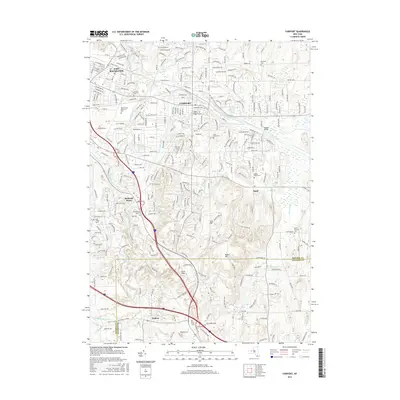
2016 Map of Fairport
USGS Topo · Published 2016About this map
The Erie Canal cuts through the heart of this landscape, anchoring the village of Fairport and the surrounding suburban development of eastern Monroe County. This modern survey illustrates the dense residential growth and commercial expansion around Eastview Mall and the hamlet of Fishers, while still preserving the footprints of older rural settlements like Egypt and Bushnell Basin. Genealogy researchers will find significant value in the numerous burial grounds preserved amidst the modern street grid, including the Old Burying Ground, Perinton Cem, and Saint Marys Cem. The terrain is defined by the significant rise of Turk Hill and Baker Hill south of the canal, where Irondequoit Creek and White Brook navigate the glacial topography. Notable transit landmarks like Knapps Bridge and the CSX rail corridor reflect the area's continued importance as a transportation corridor connecting East Rochester to points east.
Find a feature on this map
271 named features on this map. Tap any name to fly to it.
Don’t see what you’re looking for? This feature index may not catch every label — zoom into the map to look around manually.
Map Details
Editions of this 2016 Fairport Map
This is the sole edition of this map. No revisions or reprints were ever made.
Other maps of this area

1895 · Rochester
USGS Topo · 1:62,500

1898 · Rochester
USGS Topo · 1:62,500

1900 · Macedon
USGS Topo · 1:62,500

1900 · Canandaigua
USGS Topo · 1:62,500

1901 · Honeoye
USGS Topo · 1:62,500

1903 · Canandaigua
USGS Topo · 1:62,500

1904 · Honeoye
USGS Topo · 1:62,500

1912 · Rochester
USGS Topo · 1:62,500

1920 · Rochester
USGS Topo · 1:62,500

1931 · Mendon Ponds
USGS Topo · 1:24,000