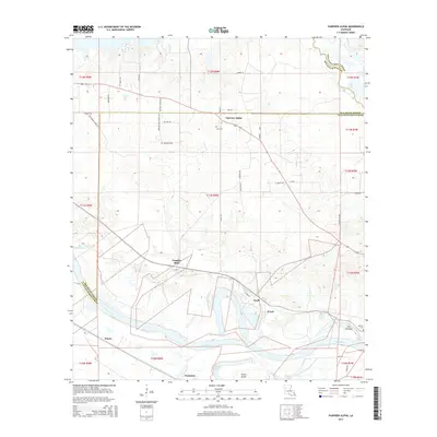
2015 Map of Fairview Alpha
USGS Topo · Published 2015About this map
Red River oxbows and bottomlands dominate this section of Louisiana, where the border between Red River and Natchitoches Parish follows the shifting historical course of the water. The community of Fairview Alpha sits on higher ground to the north, served by a network of rural roads such as Bethany Pres Church Rd and Kees Rd. This region is characterized by its complex hydrology, featuring numerous named bodies of water including Black Lake, Flag Lake, and Passoit Lake.
Find a feature on this map
49 named features on this map. Tap any name to fly to it.
Don’t see what you’re looking for? This feature index may not catch every label — zoom into the map to look around manually.
Map Details
Editions of this 2015 Fairview Alpha Map
This is the sole edition of this map. No revisions or reprints were ever made.
Other maps of this area

1937 · Campti NE
USGS Topo · 1:31,680

1937 · Campti SE
USGS Topo · 1:31,680

1937 · Campti NW
USGS Topo · 1:31,680

1937 · Campti SW
USGS Topo · 1:31,680

1938 · Allen
USGS Topo · 1:31,680

1938 · Lake End
USGS Topo · 1:31,680

1944 · Campti
USGS Topo · 1:62,500

1947 · Ashland
USGS Topo · 1:62,500

1947 · Hanna
USGS Topo · 1:62,500

1948 · Coushatta
USGS Topo · 1:62,500