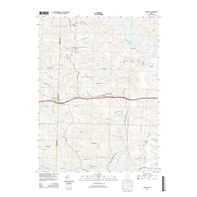
2013 Map of Fairview
USGS Topo · Published 2013About this map
The boundary between Guernsey Co and Belmont Co bisects this eastern Ohio landscape, where the ridges and valleys dictate the paths of early routes and local communities. In the village of Fairview, the Old National Rd traces a historical path eastward through Hendrysburg, paralleling the modern interstate corridor. The map reveals a dense network of family and community landmarks, including Gibson Cem and Sewellsville Cem, which sit atop the high ground overlooking drainages like Robinson Run and Indian Run. To the northeast, the shoreline of Piedmont Lake creates a distinct recreational and geographical boundary, while industrial land use is evidenced by the Consolidation Coal Company Pond 0010 to the southeast. These features, along with the Barnesville-Bradfield Airport, illustrate the continuing evolution of a region rooted in small-town settlement and resource management.
Find a feature on this map
87 named features on this map. Tap any name to fly to it.
Don’t see what you’re looking for? This feature index may not catch every label — zoom into the map to look around manually.
Map Details
Editions of this 2013 Fairview Map
This is the sole edition of this map. No revisions or reprints were ever made.
Other maps of this area

1903 · Flushing
USGS Topo · 1:62,500

1905 · Woodsfield
USGS Topo · 1:62,500

1905 · Flushing
USGS Topo · 1:62,500

1909 · Antrim
USGS Topo · 1:48,000

1909 · Summerfield
USGS Topo · 1:62,500

1911 · Antrim
USGS Topo · 1:62,500

1911 · Summerfield
USGS Topo · 1:62,500

1949 · Clarksburg
USGS Topo · 1:250,000

1951 · Canton
USGS Topo · 1:250,000

1953 · Canton
USGS Topo · 1:250,000