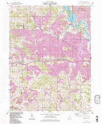
1994 Map of Fairview
USGS Topo · Published 1998About this map
Egypt Valley dominates the northern landscape of this region, characterized by extensive Strip Mine operations and industrial land use alongside the conservation efforts of the Egypt Valley State Wildlife Area. This corner of Ohio at the Guernsey and Belmont county line reveals a landscape of reclamation and recovery, where former mining pits sit adjacent to the protected waters of Piedmont Lake and the Kirkwood State Wildlife Area. Traditional rural settlements like Sewellsville, Hendrysburg, and Fairview are clustered along the arterial roads, while the southern reaches of the quadrangle feature the Baltimore and Ohio railroad corridor. Local history is anchored by several burial grounds including Fairview Cem and Hope Cem, reflecting the generations who worked the mines and farms of Oxford and Warren townships.
Find a feature on this map
37 named features on this map. Tap any name to fly to it.
Don’t see what you’re looking for? This feature index may not catch every label — zoom into the map to look around manually.
Map Details
Editions of this 1994 Fairview Map
This is the sole edition of this map. No revisions or reprints were ever made.
Other maps of this area

1903 · Flushing
USGS Topo · 1:62,500

1905 · Woodsfield
USGS Topo · 1:62,500

1905 · Flushing
USGS Topo · 1:62,500

1909 · Antrim
USGS Topo · 1:48,000

1909 · Summerfield
USGS Topo · 1:62,500

1911 · Antrim
USGS Topo · 1:62,500

1911 · Summerfield
USGS Topo · 1:62,500

1949 · Clarksburg
USGS Topo · 1:250,000

1951 · Canton
USGS Topo · 1:250,000

1953 · Canton
USGS Topo · 1:250,000