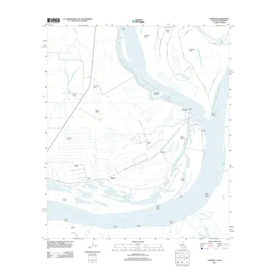
2012 Map of Fairview
USGS Topo · Published 2012About this map
The shifting course of the Mississippi River dominates this 2012 survey, where the boundary between Louisiana and Mississippi is defined by the legacy of the Old River and the engineered Glasscock Cutoff Revetment. The landscape is a mosaic of active petroleum extraction and alluvial agriculture, evidenced by numerous production sites like the Glasscock Island Oil Field, Brabston Oil Field, and Roseland Oil Field. The riverbanks are marked by a series of historic river access points including Ashley Landing, Eureka Landing, and Fairview Landing.
Find a feature on this map
46 named features on this map. Tap any name to fly to it.
Don’t see what you’re looking for? This feature index may not catch every label — zoom into the map to look around manually.
Map Details
Editions of this 2012 Fairview Map
This is the sole edition of this map. No revisions or reprints were ever made.
Other maps of this area

1936 · Woodville
USGS Topo · 1:62,500

1939 · Kingston
USGS Topo · 1:62,500

1939 · Artonish
USGS Topo · 1:62,500

1939 · Deer Park
USGS Topo · 1:62,500

1953 · Natchez
USGS Topo · 1:250,000

1954 · Artonish
USGS Topo · 1:62,500

1955 · Artonish
USGS Topo · 1:62,500

1956 · Natchez
USGS Topo · 1:250,000

1958 · Artonish
USGS Topo · 1:62,500

1958 · Woodville
USGS Topo · 1:62,500