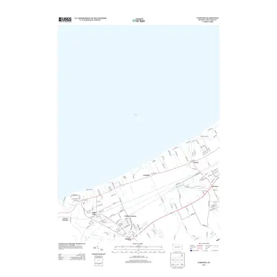
2013 Map of Fairview
USGS Topo · Published 2013About this map
Lake Erie defines the northern extent of this Erie County landscape, where the shoreline is dotted with summer retreats and recreational sites such as Camp Sherwin, Camp Caledon, and Great Lakes Camp. Inland, the area is anchored by the residential and commercial centers of Lake City, Girard, and Fairview. The map illustrates a dense transportation and utility corridor, highlighted by the strategic rail connections at Wallace Junction and Girard Junction. These points historically served as critical nodes for moving freight along the Great Lakes shore. Waterways like Elk Cr and Trout Run cut through the terrain toward the lake, influencing the placement of early settlements and roads like Old Lake Rd and Middle Rd. This 2013 survey provides a contemporary view of these long-established communities and their relationship to the shoreline and rail infrastructure.
Find a feature on this map
124 named features on this map. Tap any name to fly to it.
Don’t see what you’re looking for? This feature index may not catch every label — zoom into the map to look around manually.
Map Details
Editions of this 2013 Fairview Map
This is the sole edition of this map. No revisions or reprints were ever made.
Other maps of this area

1899 · Erie
USGS Topo · 1:62,500

1900 · Girard
USGS Topo · 1:62,500

1900 · Erie
USGS Topo · 1:62,500

1900 · Fairview
USGS Topo · 1:62,500

1923 · Cambridge Springs
USGS Topo · 1:62,500

1925 · Cambridge Springs
USGS Topo · 1:62,500

1943 · Cambridge Springs
USGS Topo · 1:62,500

1950 · Cleveland
USGS Topo · 1:250,000

1950 · Erie
USGS Topo · 1:250,000

1956 · Cleveland
USGS Topo · 1:250,000