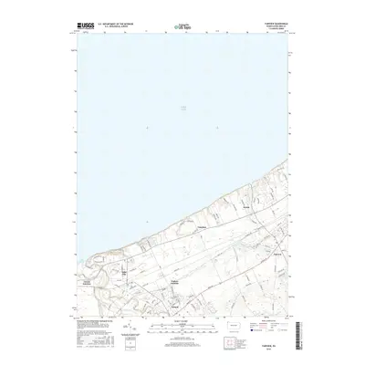
2016 Map of Fairview
USGS Topo · Published 2016About this map
Lake Erie defines the northern edge of this coastal landscape, where the shoreline meets a network of established Erie County communities. The area is characterized by the convergence of rail corridors and rural roads, with Girard Junction and Wallace Junction serving as critical nodes in the local transportation infrastructure. These junctions facilitate movement between the larger hubs of Girard and Lake City, while smaller settlements like Avonia and Fairplain occupy the stretches between the lakefront and the interior.
Find a feature on this map
84 named features on this map. Tap any name to fly to it.
Don’t see what you’re looking for? This feature index may not catch every label — zoom into the map to look around manually.
Map Details
Editions of this 2016 Fairview Map
This is the sole edition of this map. No revisions or reprints were ever made.
Other maps of this area

1899 · Erie
USGS Topo · 1:62,500

1900 · Girard
USGS Topo · 1:62,500

1900 · Erie
USGS Topo · 1:62,500

1900 · Fairview
USGS Topo · 1:62,500

1923 · Cambridge Springs
USGS Topo · 1:62,500

1925 · Cambridge Springs
USGS Topo · 1:62,500

1943 · Cambridge Springs
USGS Topo · 1:62,500

1950 · Cleveland
USGS Topo · 1:250,000

1950 · Erie
USGS Topo · 1:250,000

1956 · Cleveland
USGS Topo · 1:250,000