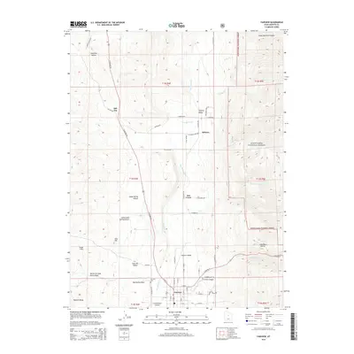
2014 Map of Fairview
USGS Topo · Published 2014About this map
Sanpete Valley serves as the central corridor for this 2014 landscape, where the San Pitch River winds through a patchwork of agricultural and residential grids. The town of Fairview anchors the southern portion of the sheet, situated at the junction of N State St and the road leading toward Fairview Canyon. To the north, smaller settlements like Milburn and Hill Top are linked by a network of rural routes including N Milburn Rd and Peterson Rd.
Find a feature on this map
64 named features on this map. Tap any name to fly to it.
Don’t see what you’re looking for? This feature index may not catch every label — zoom into the map to look around manually.
Map Details
Editions of this 2014 Fairview Map
This is the sole edition of this map. No revisions or reprints were ever made.
Other maps of this area

1885 · Manti
USGS Topo · 1:250,000

1895 · Manti
USGS Topo · 1:250,000

1951 · Moroni
USGS Topo · 1:62,500

1952 · Santaquin Peak
USGS Topo · 1:62,500

1956 · Price
USGS Topo · 1:250,000

1960 · Price
USGS Topo · 1:250,000

1962 · Price
USGS Topo · 1:250,000

1965 · Huntington Reservoir
USGS Topo · 1:24,000

1965 · Fairview Lakes
USGS Topo · 1:24,000
1967 · Indianola
USGS Topo · 1:24,000