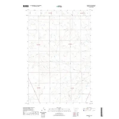
2020 Map of Fairview SW
USGS Topo · Published 2020About this map
Brorson Cr and various branches of Hay Creek define this rural expanse in Richland County, where the high plains of Eastern Montana transition into an irrigated agricultural landscape. The southern portion of the sheet reveals the vital water infrastructure of the region, including the Main Canal and Lateral G, which are essential for supporting local farmstead operations. This network of irrigation channels, alongside a natural Spring, highlights the historical effort to manage water in a semi-arid environment. The township grid is well-defined by an extensive system of county roads, such as Co RD 128 and Co RD 346, connecting isolated ranch lands and providing a glimpse into the late 20th and early 21st-century land use patterns of the Big Sky State.
Find a feature on this map
25 named features on this map. Tap any name to fly to it.
Don’t see what you’re looking for? This feature index may not catch every label — zoom into the map to look around manually.
Map Details
Editions of this 2020 Fairview SW Map
This is the sole edition of this map. No revisions or reprints were ever made.
Other maps of this area

1909 · Glendive
USGS Topo · 1:250,000

1954 · Glendive
USGS Topo · 1:250,000

1957 · Glendive
USGS Topo · 1:250,000

1958 · Glendive
USGS Topo · 1:250,000

1966 · Crane NE
USGS Topo · 1:24,000

1966 · Sidney NE
USGS Topo · 1:24,000

1966 · Sidney
USGS Topo · 1:24,000
1968 · Dore
USGS Topo · 1:24,000

1972 · Brorson
USGS Topo · 1:24,000
1972 · Fairview
USGS Topo · 1:24,000