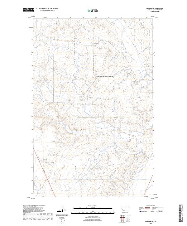
2024 Map of Fairview SW
USGS Topo · Published 2024About this map
First Hay Creek and its north fork cut across this portion of Richland County, defining the drainage patterns of this high plains landscape. The map reveals a highly structured environment of section lines and gravel roads, including Co RD 129 and Co RD 128, which serve the dispersed homesteads and agricultural operations of the region. A shift in land use is visible in the southeastern corner, where the Main Canal and Lateral G introduce irrigation infrastructure to the drainage of Second Hay Creek. This transition from dryland coulees to managed water systems illustrates the modern engineering required to sustain production in the semi-arid Montana climate. The presence of these canals alongside traditional seasonal watercourses highlights the intersection of natural topography and human resource management.
Find a feature on this map
23 named features on this map. Tap any name to fly to it.
Don’t see what you’re looking for? This feature index may not catch every label — zoom into the map to look around manually.
Map Details
Editions of this 2024 Fairview SW Map
This is the sole edition of this map. No revisions or reprints were ever made.
Other maps of this area

1909 · Glendive
USGS Topo · 1:250,000

1954 · Glendive
USGS Topo · 1:250,000

1957 · Glendive
USGS Topo · 1:250,000

1958 · Glendive
USGS Topo · 1:250,000

1966 · Crane NE
USGS Topo · 1:24,000

1966 · Sidney NE
USGS Topo · 1:24,000

1966 · Sidney
USGS Topo · 1:24,000
1968 · Dore
USGS Topo · 1:24,000

1972 · Brorson
USGS Topo · 1:24,000
1972 · Fairview
USGS Topo · 1:24,000