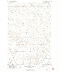
1972 Map of Fairview SW
USGS Topo · Published 1975About this map
North Fork Hay Creek and several other branches of the Hay Creek drainage system define this portion of Richland County as it appeared in the early 1970s. The landscape is characterized by a network of drainage forks including Second Hay Creek, Third Hay Creek, and First Hay Creek, which carve through the terrain before meeting the irrigation infrastructure in the south. The presence of numerous Oil Wells across the hillsides points to the era's active energy exploration in the Williston Basin region.
Find a feature on this map
13 named features on this map. Tap any name to fly to it.
Don’t see what you’re looking for? This feature index may not catch every label — zoom into the map to look around manually.
Map Details
Editions of this 1972 Fairview SW Map
This is the sole edition of this map. No revisions or reprints were ever made.
Other maps of this area

1909 · Glendive
USGS Topo · 1:250,000

1954 · Glendive
USGS Topo · 1:250,000

1957 · Glendive
USGS Topo · 1:250,000

1958 · Glendive
USGS Topo · 1:250,000

1966 · Crane NE
USGS Topo · 1:24,000

1966 · Sidney NE
USGS Topo · 1:24,000

1966 · Sidney
USGS Topo · 1:24,000
1968 · Dore
USGS Topo · 1:24,000

1972 · Brorson
USGS Topo · 1:24,000
1972 · Fairview
USGS Topo · 1:24,000