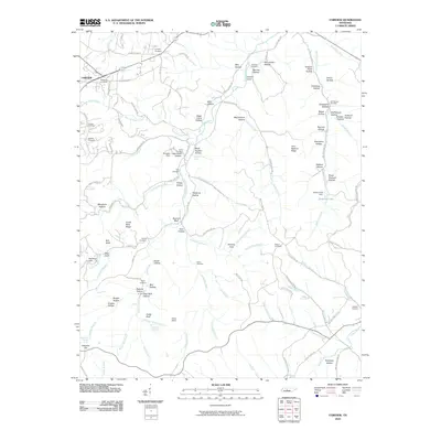
2010 Map of Fairview
USGS Topo · Published 2010About this map
South Harpeth River and its numerous tributaries, including Kelly Creek, Arkansas Creek, and East Fork Creek, define the landscape of this Tennessee region. The town of Fairview occupies the northwest corner, while the Natchez Trace Pkwy winds through the southeast, following the ridge lines and historical travel corridors. This 2010 survey highlights a deeply dissected terrain characterized by named hollows and ridges such as Tobacco Patch Hollow, Booger Hollow, and Crane Neck Ridge. For genealogists, the map is particularly rich with small family burial grounds, such as Lampley Cemetery, Pewitt Cemetery, and Inman Cemetery, which often sit adjacent to historical residences or former homesteads. Local hydrology is detailed through features like Blowing Spring, Mayfield Spring, and the Baptizing Hole, suggesting long-standing community sites centered on the area's water sources.
Find a feature on this map
119 named features on this map. Tap any name to fly to it.
Don’t see what you’re looking for? This feature index may not catch every label — zoom into the map to look around manually.
Map Details
Editions of this 2010 Fairview Map
This is the sole edition of this map. No revisions or reprints were ever made.
Other maps of this area

1901 · Colombia
USGS Topo · 1:125,000

1903 · Nashville
USGS Topo · 1:125,000

1909 · Franklin
USGS Topo · 1:62,500

1930 · White Bluff
USGS Topo · 1:62,500

1932 · Nashville
USGS Topo · 1:62,500

1933 · White Bluff
USGS Topo · 1:62,500

1936 · Primm
USGS Topo · 1:24,000

1936 · Spring Hill
USGS Topo · 1:24,000

1936 · Theta
USGS Topo · 1:24,000

1936 · Craigfield
USGS Topo · 1:24,000