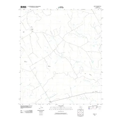
2010 Map of Fairy
USGS Topo · Published 2010About this map
Fairy and Lanham anchor this rural landscape in Hamilton County, where the topography is defined by a series of prominent peaks and gaps. The local drainage pattern is dominated by the upper reaches of Meridian Creek and its branches, including North Prong Meridian Creek and South Prong Meridian Creek. The terrain is punctuated by distinctive high points such as Lone Mountain, Twin Mountains, and Stroud Mountain, with Martin Gap serving as a natural pass near the Fairy settlement. For those researching family history in the area, the Fairy Cemetery is a significant landmark situated just north of the town center. The map also traces a network of farm-to-market roads and county routes, such as FM 219 and FM 1602, that link these small Texas communities across the watershed of North Fork Neils Creek.
Find a feature on this map
32 named features on this map. Tap any name to fly to it.
Don’t see what you’re looking for? This feature index may not catch every label — zoom into the map to look around manually.
Map Details
Editions of this 2010 Fairy Map
This is the sole edition of this map. No revisions or reprints were ever made.
Other maps of this area

1888 · Hamilton
USGS Topo · 1:125,000

1888 · Meridian
USGS Topo · 1:125,000

1894 · Hamilton
USGS Topo · 1:125,000

1894 · Meridian
USGS Topo · 1:125,000

1954 · Brownwood
USGS Topo · 1:250,000

1954 · Waco
USGS Topo · 1:250,000

1955 · Waco
USGS Topo · 1:250,000

1956 · Cranfills Gap
USGS Topo · 1:24,000
1956 · German Valley
USGS Topo · 1:24,000

1956 · Hico
USGS Topo · 1:62,500