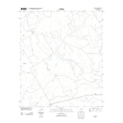
2012 Map of Fairy
USGS Topo · Published 2012About this map
The community of Fairy serves as the central settlement in this Hamilton County landscape, situated near Martin Gap and the local Fairy Cem. The terrain is defined by a series of prominent rises including Twin Mountains, Lone Mtn, and Paul Mtn, which overlook a complex network of seasonal and perennial watercourses. This drainage system includes Meridian Cr, its northern and southern prongs, and Egg Cr, all carved into the Texas limestone. In the southern portion of the sheet, the settlement of Lanham anchors the map near the headwaters of N Fork Neils Cr. The map illustrates a rural Texas ranching and farming district, where the placement of farm-to-market roads and county routes follows the natural contours of the hills and creek beds, reflecting a long-standing pattern of regional land use.
Find a feature on this map
35 named features on this map. Tap any name to fly to it.
Don’t see what you’re looking for? This feature index may not catch every label — zoom into the map to look around manually.
Map Details
Editions of this 2012 Fairy Map
This is the sole edition of this map. No revisions or reprints were ever made.
Other maps of this area

1888 · Hamilton
USGS Topo · 1:125,000

1888 · Meridian
USGS Topo · 1:125,000

1894 · Hamilton
USGS Topo · 1:125,000

1894 · Meridian
USGS Topo · 1:125,000

1954 · Brownwood
USGS Topo · 1:250,000

1954 · Waco
USGS Topo · 1:250,000

1955 · Waco
USGS Topo · 1:250,000

1956 · Cranfills Gap
USGS Topo · 1:24,000
1956 · German Valley
USGS Topo · 1:24,000

1956 · Hico
USGS Topo · 1:62,500